Preserved towers orientation
Read the northern coast at a glance before you step into the full map.
Symbols mark surviving lighthouse towers, documented ruins, and high viewpoints so each pin can be read as part of a longer coastal record.
Legend:
Preserved towers
Ruins
Viewpoints
Open the preserved towers map
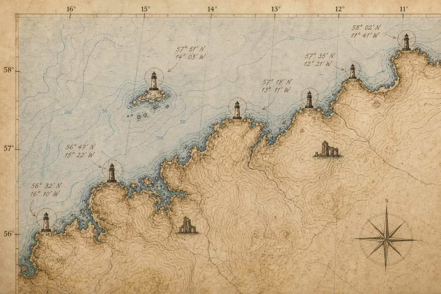
Preserved towers map
Explore preserved lighthouses along the northern coast.
A static illustrated reference showing documented tower sites, coastal spacing, and short labels for quick geographic orientation.
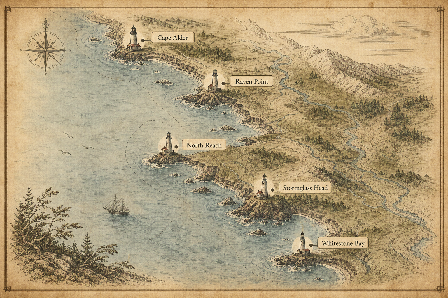
Cape Alder
Raven Point
North Reach
Stormglass Head
Whitestone Bay
Marker key
- Documented preserved tower
- Associated keeper station area
- Historic route reference point